Reunion island GRR1 trek : hike around “Le Piton des Neiges”
This article about the GRR1 trek in Reunion closes our articles about the 3 GRs of our beautiful island! This long-distance hiking trail goes around “Le Piton des Neiges”, passing through the 3 cirques. And you can find here the details of the 4 stages of our hike. Hike’s information, ideas for bivouacking or refueling water and other information on this GRR1 trek.
Hiking around the Piton des Neiges in 60km: nature and a change of scenery.
GRR1 trek, a loop through the 3 Reunion’s cirques
We did the GRR1 over 4 days, in autonomy, so 3 nights in a tent in November. A beautiful period, as the nights are starting to be less cold but we still haven’t entered the rainy season.
BIVOUAC – As a reminder, bivouac is: pitching your tent at the last light of day (or at nightfall) and packing it up at daybreak. Not to make a fire if there is no place for it and not to leave anything behind of course!
Basically come to sleep with as little inconvenience as possible and without leaving any traces of its passage!
In general, we put are tent a bit before or after villages not to bother inhabitants.
Basic information about the GRR1 trek
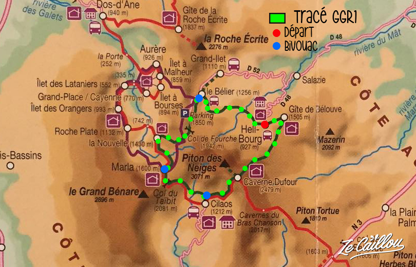
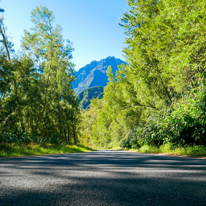
The GRR1 trek is the big trail that goes around the famous “Piton des Neiges” hiking through the 3 island’s cirques.
Salazie, Cilaos, Mafate, closer to our island!
- Distance: 63,35 km starting from Hellbourg (Salazie).
- Elevation: 4312 m+ and 4318 m-
- Markings: 2 straigts (1 red and white)
- Best periods: September-November or April-June. Nights are colder than in summer but days are cooler and there is less risk of rain.
GRR1 trek in Reunion : our stages
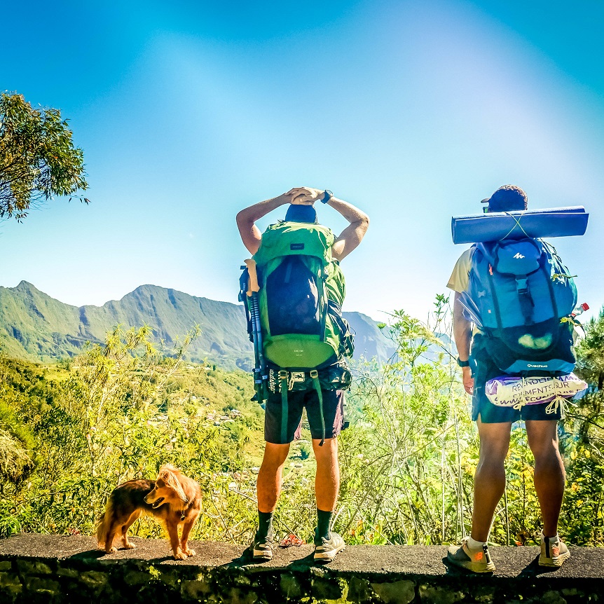
As usual, therefore having rather heavy bags (between 15 and 17kg), we decide to do this loop in 4 days to have time to stop and enjoy it. Apart from the 1st day, which is harder, it takes an average of 5 hours of walking per day. The times below do not include breaks, so allow 1 or 2 hours more.
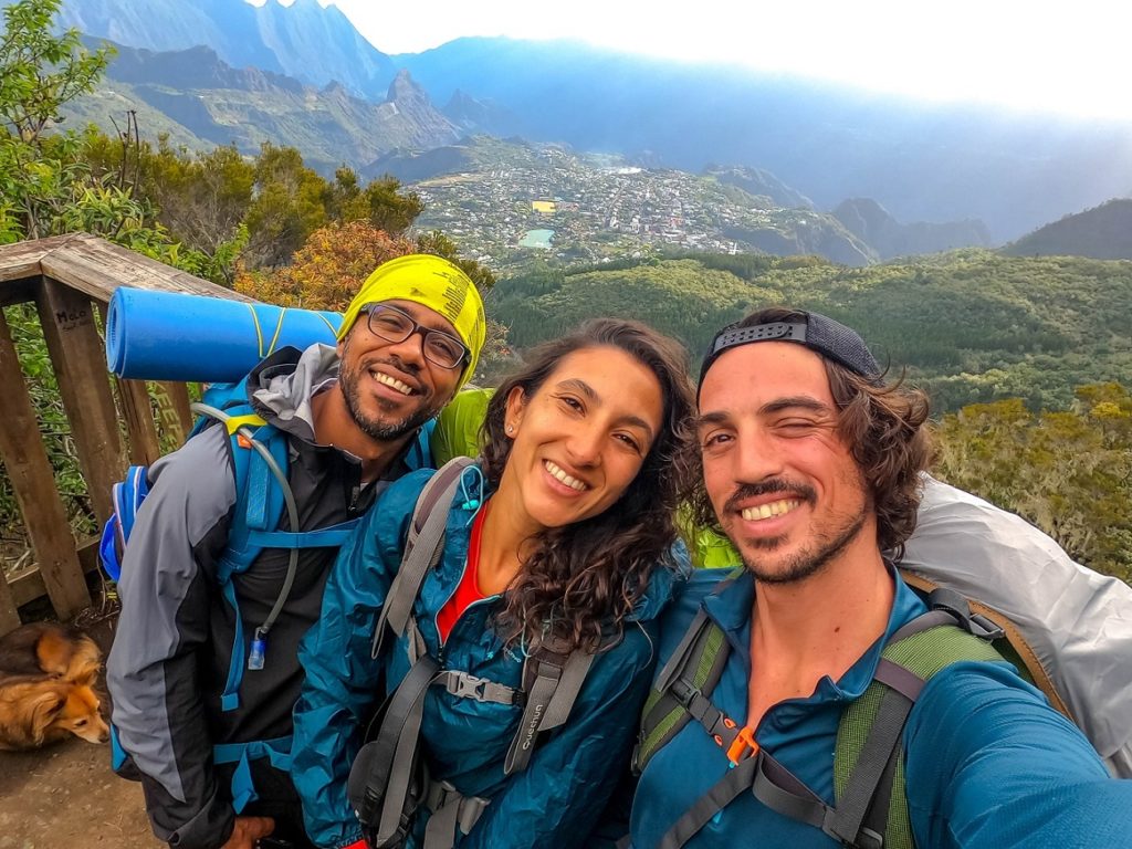
We went with our friend Eric, for a great adventure!
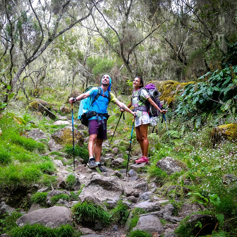
Stage 1: Hellbourg (Salazie) > Cilaos (through “Le Piton des Neiges”)
8h30 for 20,47 km
Elevation: 1688 m+ / 1332 m-
From far the hardest day of our GRR1 trek. In general, it’s recommended to shorten this stage sleeping at the “Piton des Neiges’ gite”, but we don’t really like it AND as we hike with our dog, we sleep in tent.
- Water: in Hellbourg, there is all you need to buy water and food.
- Bivouac: many spots at the start of “Bélouve’s gite ascension”, then, some others on the way to “La Caverne Dufour” and arriving at Cilaos.
From Hellbourg to Belouve’s gite
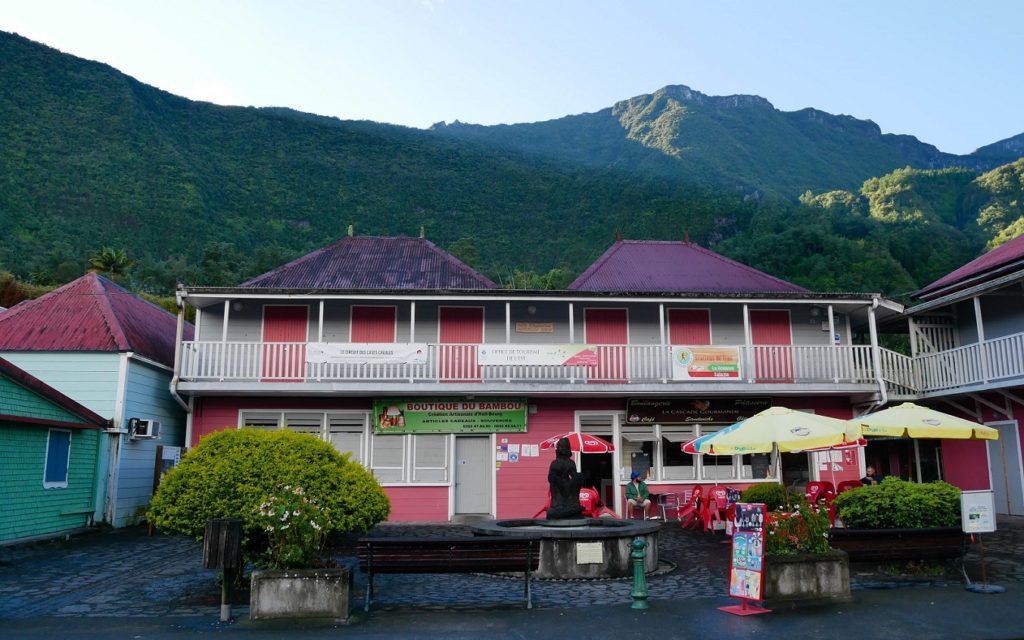
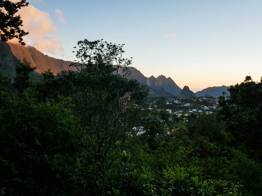
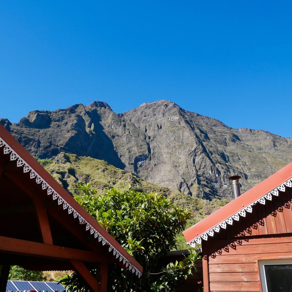
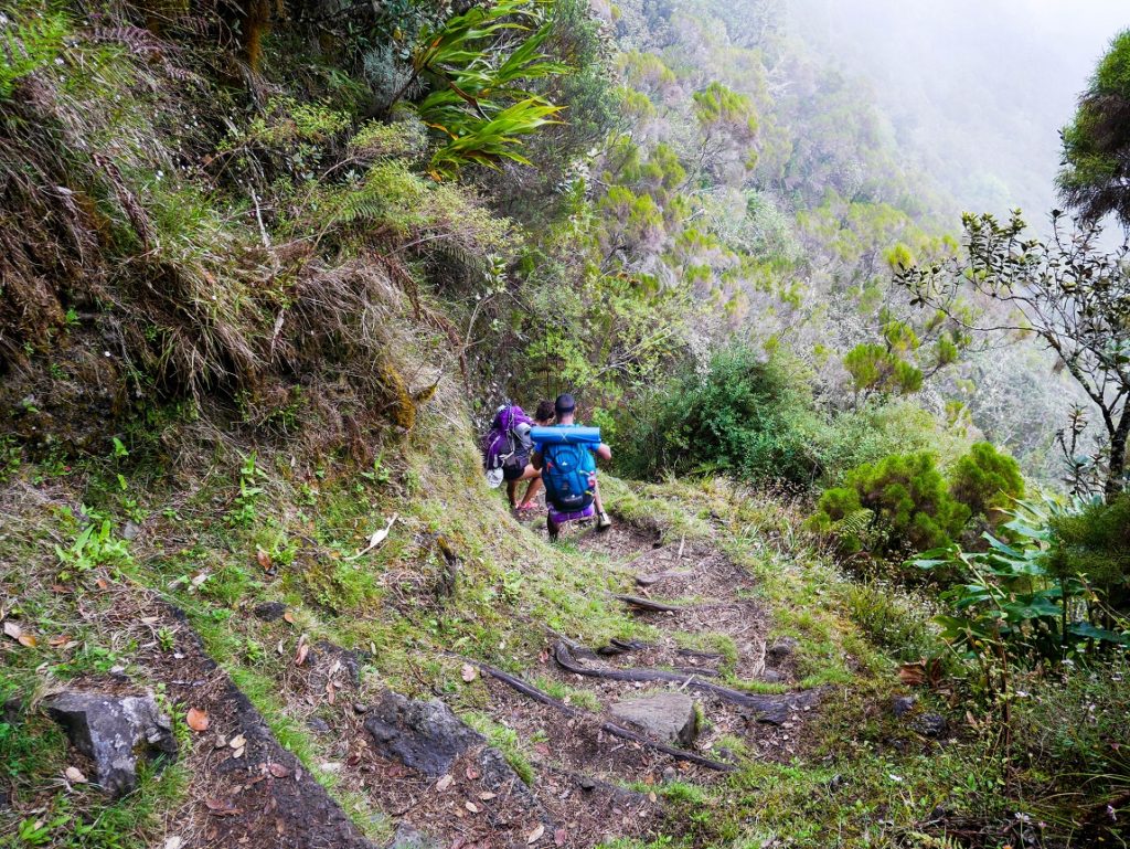
So we arrive at the small village of Hellbourg in Salazie early in the morning. It’s time to have a hearty breakfast at the bakery in the central square of the village before starting our journey! We begin by going up a small street to the start of the climb to the “Belouve’s gite”.
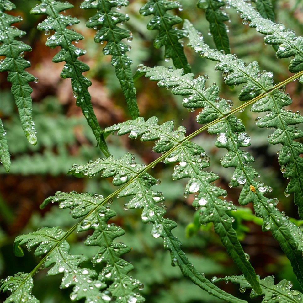
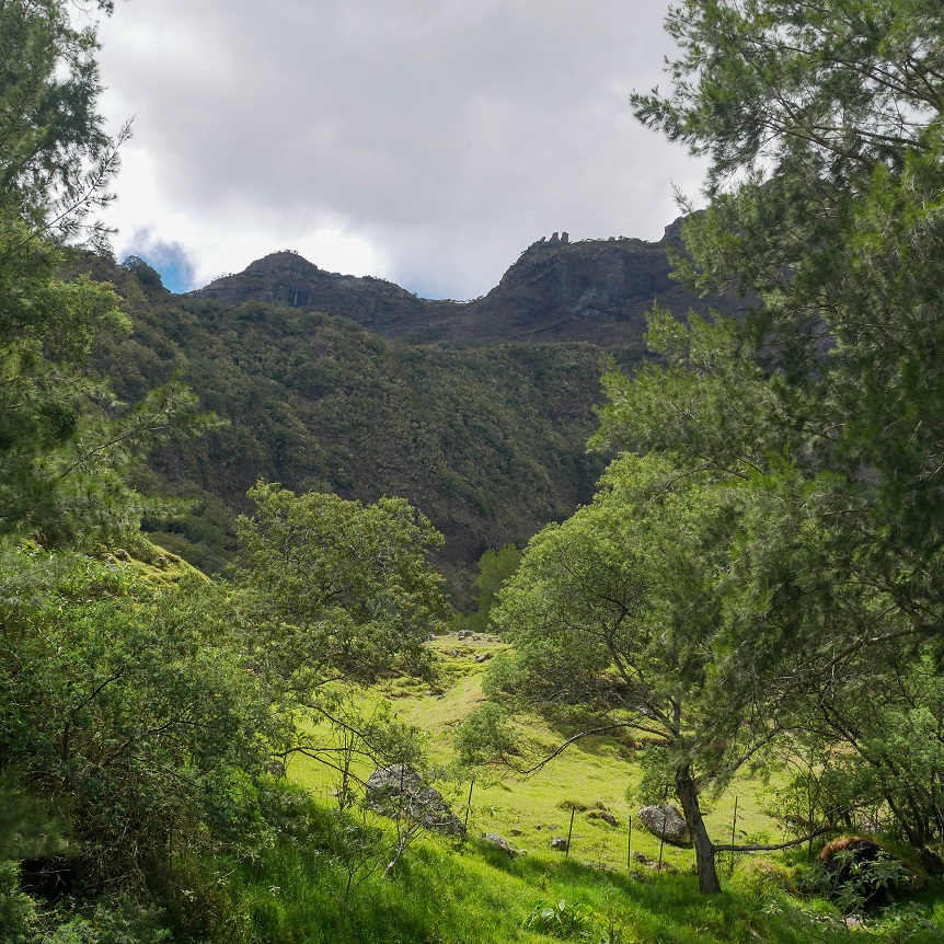
In the beginning, the weather is nice, it’s very green and the landscapes are spectacular. It only climbs up to the viewpoint over Salazie from the Bélouve gite, where there isn’t really a viewpoint anymore. The clouds arrived with a light drizzle.
From Belouve’s gîte to “la Caverne Dufour”
Then we take the direction of the Piton des Neiges’ gite. The signs indicate 5 am, indeed, it is the longest part of the day. It’s uphill, wet and muddy, luckily there are plenty of walkways made to avoid ending up in the mud! The landscapes are beautiful, we are immersed in nature.
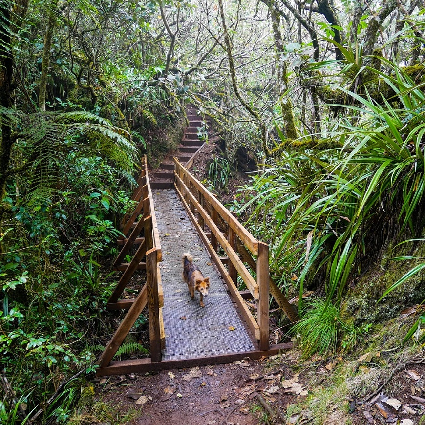
We stop after a while for a picnic. It’s not raining anymore but it’s all wet. So we don’t stop very long. There are several spots to bivouac, but it must be very cold in the evening. We continue to Cap Anglais, hey, just 1h30 until we arrive to the gite… so still at least 3 or 4 hours until our bivouac spot in Cilaos.
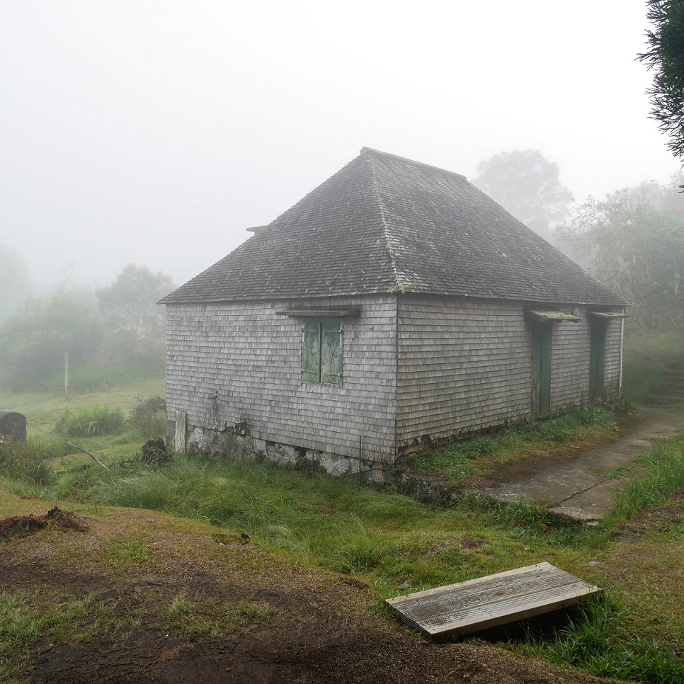
And we finally arrive at the gîte and at the junction to go to the summit of Piton des Neiges. We went there not even 4 months ago, so we skip it! But the view from Reunion Island’s highest peak is always impressive, so if you’ve never done it, now might be the time!
From the Piton des Neiges gite to Cilaos
From there it goes downhill! And after a photo stop overlooking Cilaos with Eric, we leave. Because casually, the sun has just set and we have still some kilometers to walk to “Le Plateau des Chênes”. On the way, there is a small shop, we take 3 well-deserved beers and continue. We arrive just before dark.
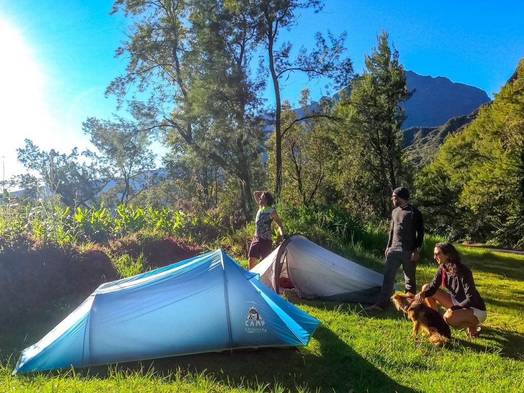
Bivouac at Plateau des Chênes
We finally stop and install our tents. There is a tap water faucet not far. And Irene, a friend, joins us to share the next stage with us!
Great picnic, pique-nique with starter / main course / dessert, but after this long day, we don’t last long!
Stage 2: Cilaos > Marla
5h30 for 12,93 km
Elevation: 1294 m+ / 1016 m-
Day much easier than the one before, with nice places to swim but still you’ll have to hike with high elevation.
- Water: there is water on the path (basins and waterfalls), but also a little source (Jacok source) on your right when you begin to climb “Le Taibit”, and of course in Marla.
- Bivouac’s spots : several spots on “Le Taibit” picnic area. There are also kiosks and bins. Other small spots (1 or 2 tents) when climbing Taibit and in Marla, close to the scool.
From Plateau des Chênes to “Le Taibit” start
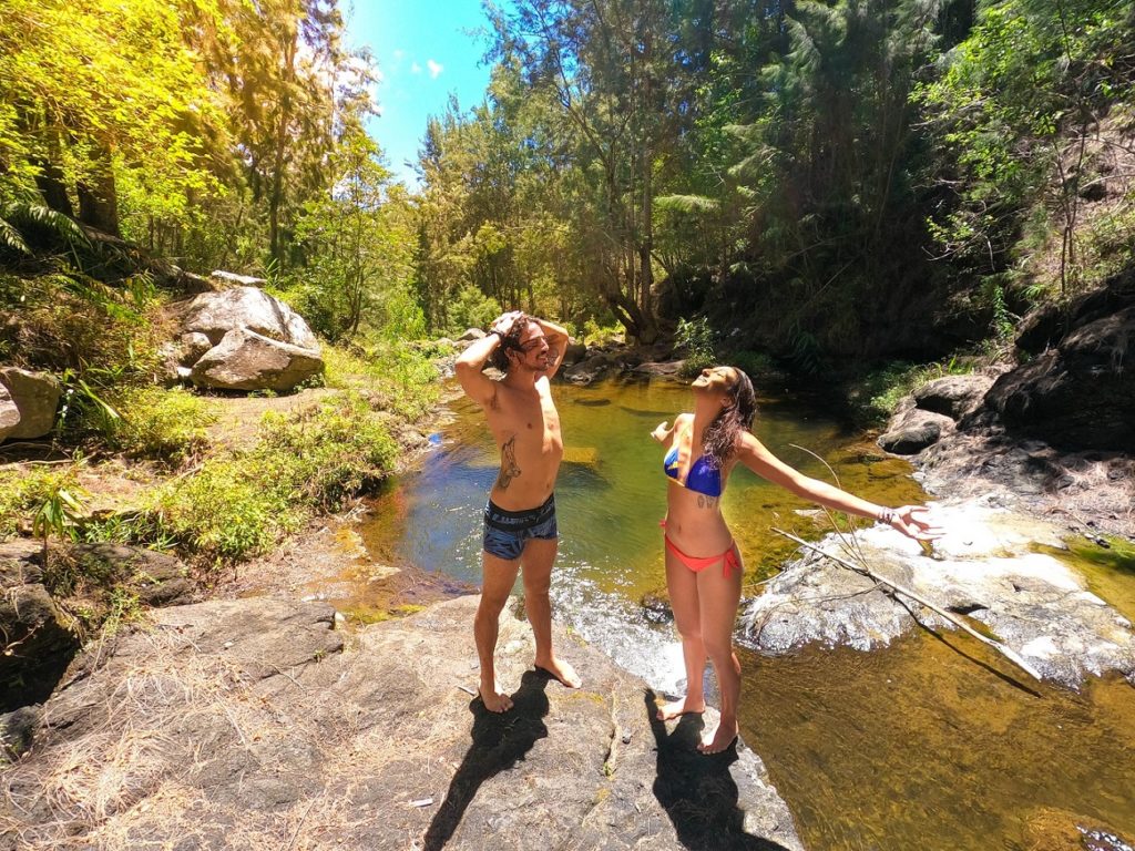
We start the day in a good mood and under the sun. We have breakfast and pack up our things. After not even 10 mins, we stop for a swim in one of the small natural pools on the way. It’s so refreshing, a real Reunion’s shower… then we start again.
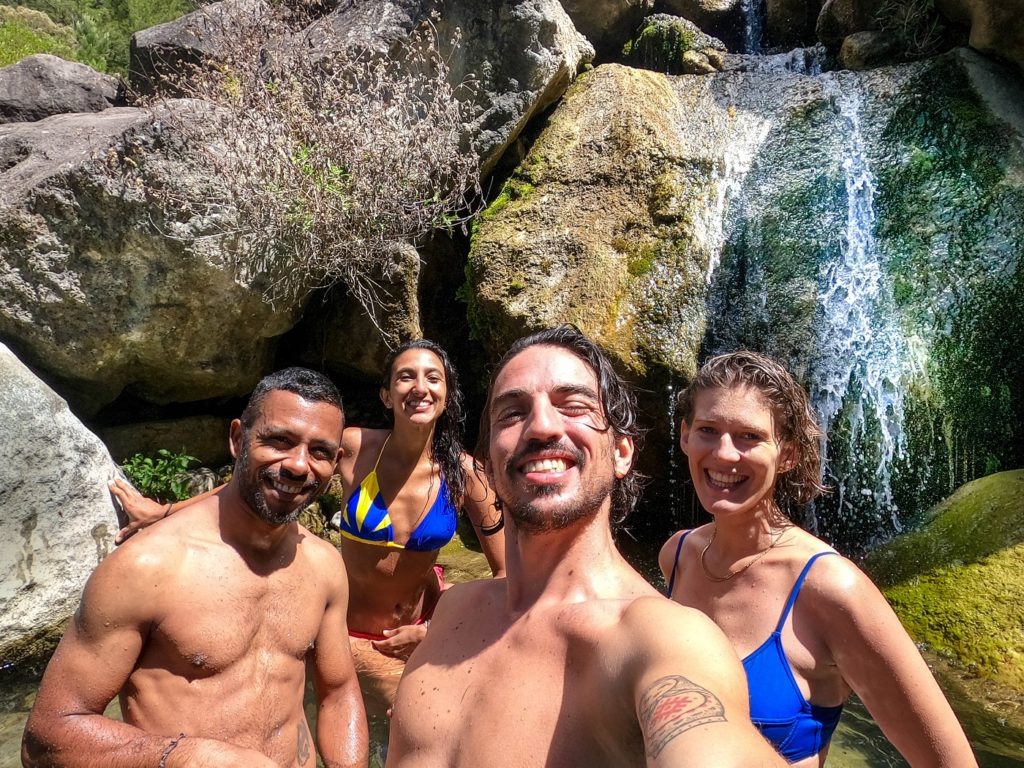
On the way to Taibit, we cross the road and go down the path just after the “Bois Rouge” bus stop. We take a break again at the waterfall in the Bras de Cilaos. The weather is great and it makes you want to stop everywhere. But after swimming, we leave. We finally arrive on the road at the start of the trail for the Col du Taibit.
From Taibit trail to Marla village
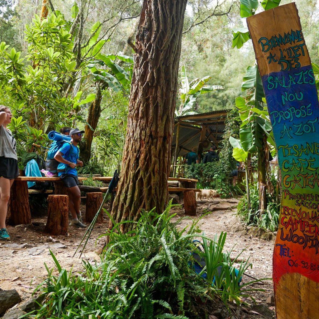
Let’s go for the more serious climb. After a few bends, there is the small “Jacob source” on the right. The water is drinkable. And even higher, we take another break at the herbal tea place on the right. Of course, we take a drink for the climb (indeed, you can enjoy a herbal tea for the climb and/or one for the descent)!
After this welcome refreshment, we start again and pass in front of the crossing for the 3 Salazes on our right (here our article on the ascent of the 3 salazes, in french). We continue in the forest towards the top of the Col du Taibit. There are a few bivouac spots but for 1 tent or 2 max. that’s it, here we are, on our right, Cilaos, and on our left Mafate, with our next stop, Marla.
We descend slowly towards the village. It’s cloudy when we arrive. But we take advantage that it is not yet too cold to rinse off at the tap at Jimmy’s (Marla’s snack bar). And of course, we stop to drink our little well deserved beer at the snack bar.
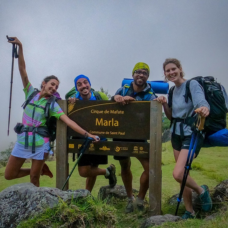
Bivouac in Marla
It’s Saturday, we warned Éric and Irène that bivouacking in the village could be… festive. Usually, if we’re there on the weekend, we move away to avoid the noise until late at night… but as we eat in a gîte, we didn’t want to leave our things too far in the middle of the night, so we chose to bivouac near the school anyway.
And as usual, you had to be very tired to fall asleep in a tent on a Saturday at Marla. Fortunately, the great aperitif and meal at Le Giroday gite combined with fatigue and headphones, allowed us to “almost ” block out the noise!
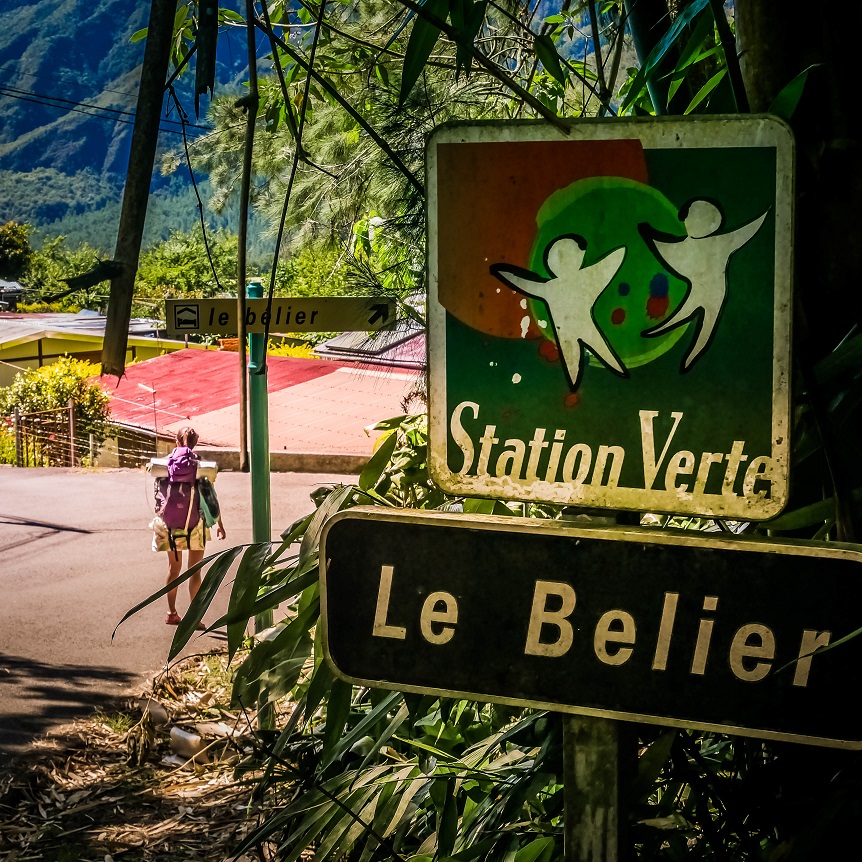
Stage 3: Marla > Le Bélier
5h15 for 15,28 km
Elevation: 828 m+ / 970 m-
A great stage, a bit easier than the 2 previous one, but a bit long after le “Col de Fourche”.
- Water: in Marla, and La Nouvelle then nothing until Le Bélier (there is a small shop at Col des Bœufs’ park lot).
- Bivouac: several spots (Maison Laclos, La Nouvelle, La Plaine des Tamarins but humid, Col des Bœufs, but cold…).
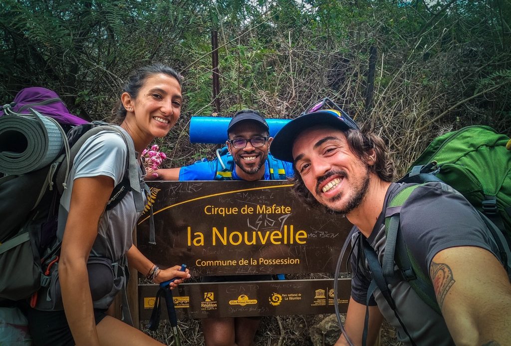
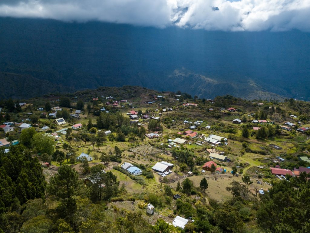
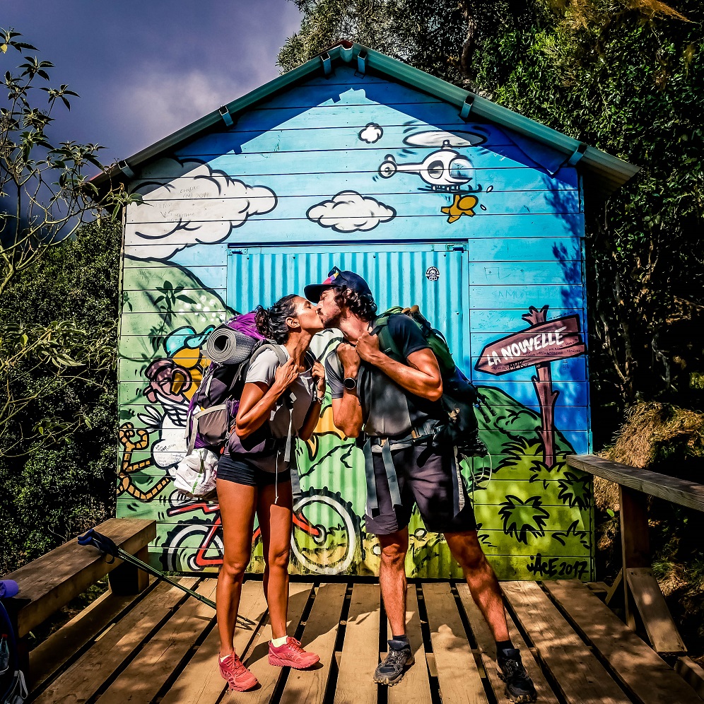
From Marla to La Nouvelle
After a breakfast with croissants at Jimmy’s (not always available), Irène says bye and go back toward Cilaos. It was great this stage the 4 of us (5 with Huaca of course), we had a lot of fun. We start again towards “La Nouvelle”, under the sun.
Ça remonte un moment jusqu’au plus grand village de Mafate.
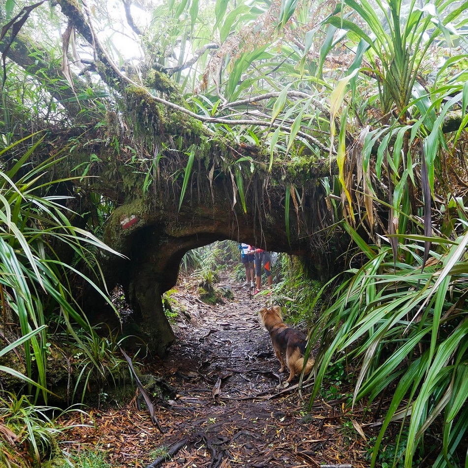
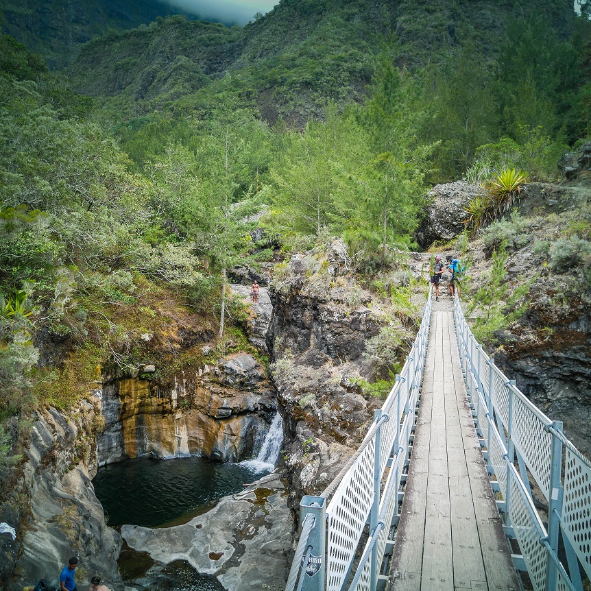
First we pass in front of the village church and the deer farm (on the right), then continue towards Maison Laclos. It’s quite fast, then we branch off to the left towards La Nouvelle via “La passerelle Ethève”. (There are 2 paths to reach La Nouvelle from Marla). We pass under casuarina trees until we reach the ponds and the footbridge that we cross.
It goes back a while to the largest village of Mafate.
Here we are, we arrive at “La Nouvelle” and as it’s sunday, there are people. We stop in a snack bar to have the lunch break. We meet some friends, but also a nasty goose that wants to bite our little Huaca.
From la Nouvelle to Col de Fourche
After lunch and little groceries, we walk towards Col des Fourche. It’s going up quite quickly to La Plaine des Tamarins. A large and green plain, with nice grass and of course many tamarinds trees ! And as there is nice grass, there are obviously cows grazing quietly.
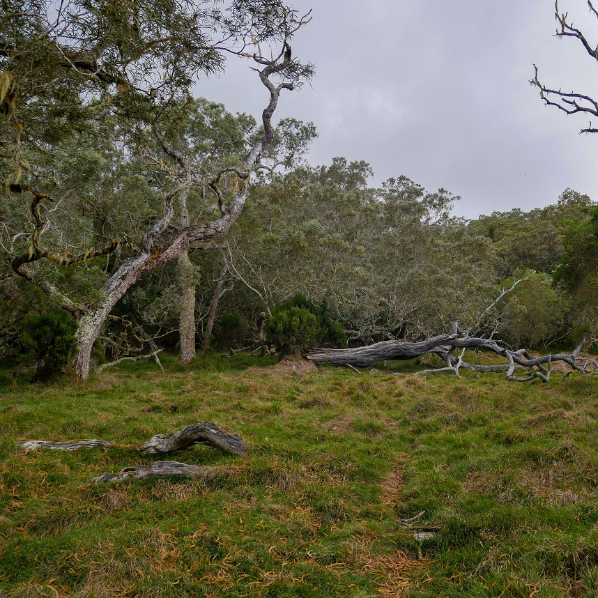
The ground is moist but quite reasonable. During and after the rains here it can be a real mud paddling pool! After crossing this pretty plain, well, it goes up.
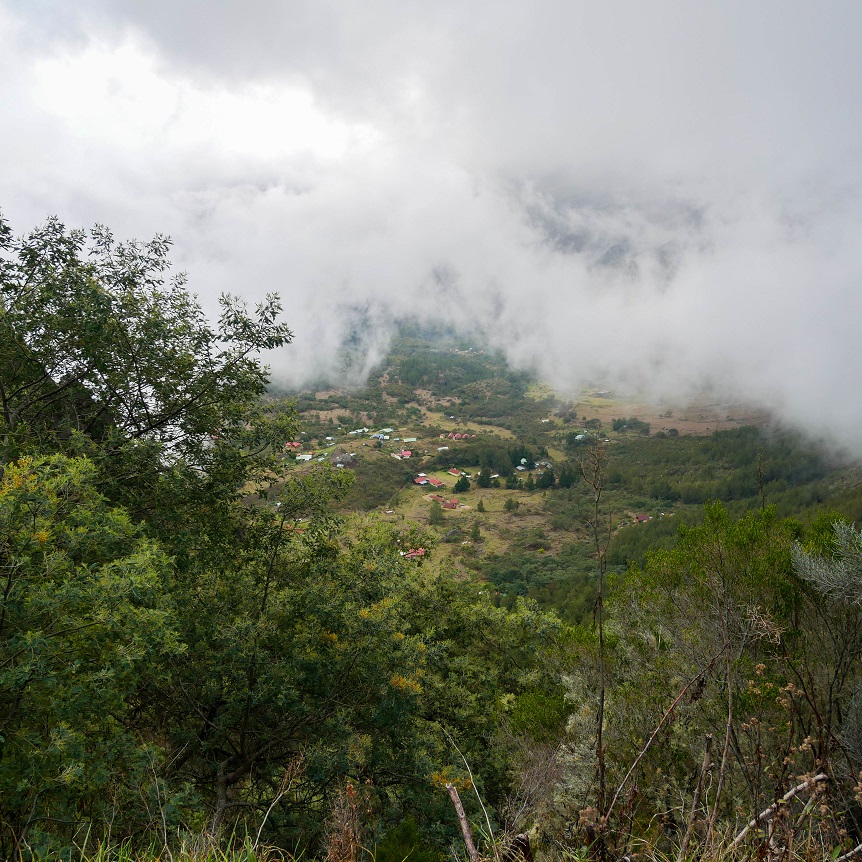
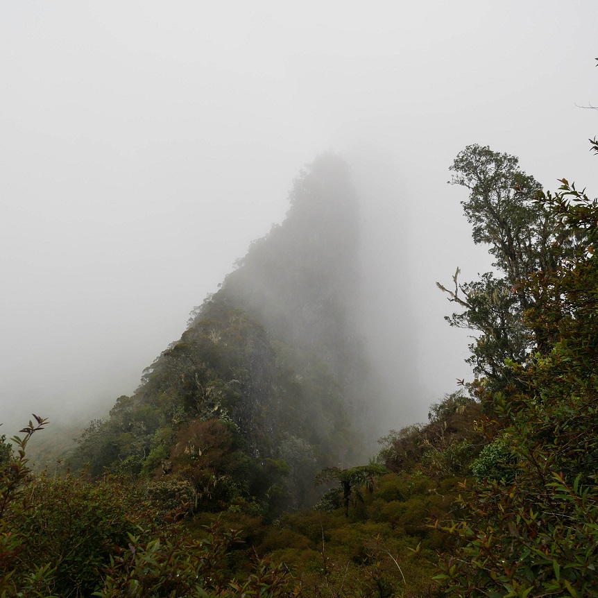
After a while, you have to turn right towards the Col de Fourche. The trail is open and yet not very well maintained, in addition the weather has deteriorated, there is a lot of fog. But we arrive at the top of the Col and let’s go downhill!
From Col de Fourche to Bélier
It’s getting late and with the fog, the light is low. We know Le Bélier and since we don’t see a place to bivouac there, so we decide to land at one of the kiosks on the way to it. It is not too cold and the weather is improving.
It’s already the last evening of our GRR1 Reunion… time flies!
It’s Sunday evening, so there is very little traffic, maybe 3 cars all evening! We take our last meal between friends… and once in the tent, the grass gives us a natural mattress, we sleep well!
Stage 4 : Le Bélier > Hellbourg
4h for 14,67 km
Elevation: 502 m+ / 1000 m-
Last day of our GRR1 trek in Reunion island… too bad. But a great day, between villages, forest, basin… still a great stage of this trail.
- Water: in Bélier village, there is a faucet and bins in a area 300 meters on your left after the little church. In the river of Grand Sable (if enough water flow), in Trou Blanc, on the way to Hellbourg and in the village of course.
- Bivouac: some spots before Bélier and at Grand Sable.
From Le Bélier to Bras Marron through Grand Sable
We wake up under the sun ! Weather is nice and our tents get dry while we breakfast !
Morale is high even though it is our last day of GRR1. There are only 10/15 mins left to reach the village of Le Belier. We recharge our camelbacks and we continue to Grand Sable.
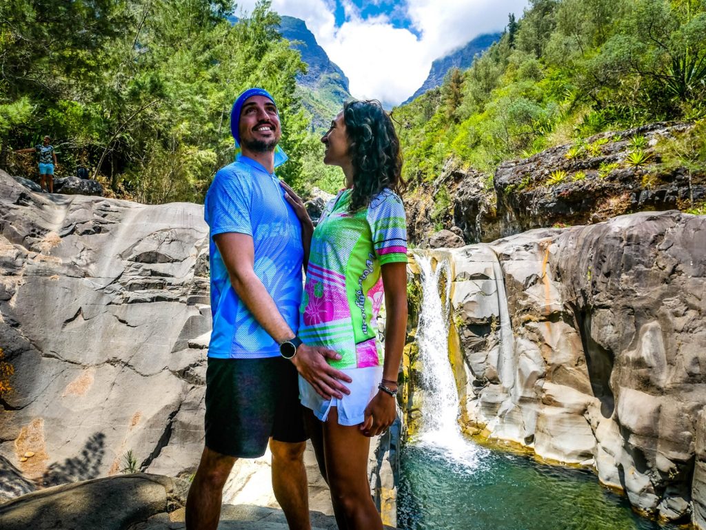
We walk a bit and do our 1st break to have a swim in a little basin (where we cross the river). There are a few more if you go up the river.
On the way, there is the path for the Piton d’Anchaing on the left, we pass our turn huh! Then we continue to the parking lot of Bras Marron. For those who know, this is the Trou Blanc canyoning car park (here is our article on a weekend in Salazie).
From Bras Marron to Hellbourg
From here, there are only 3.5 km to reach the center of Hellbourg and about 200 meters of elevation gain. On the other hand, it is very hot and the bitumen of the road is burning (the end is mainly on the road). Our Huaca, which had no problem with the entire GRR1 Reunion, is looking for shade points to avoid to hurt herself…
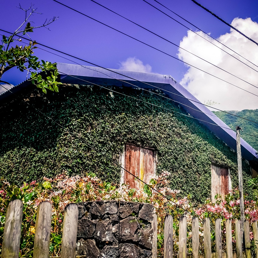
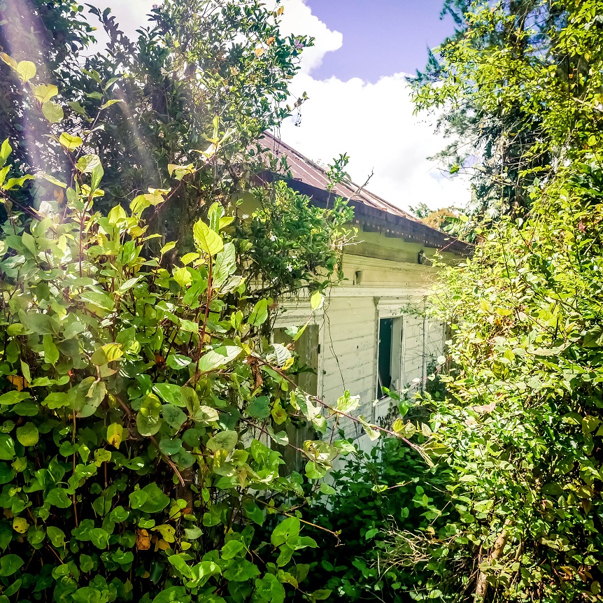
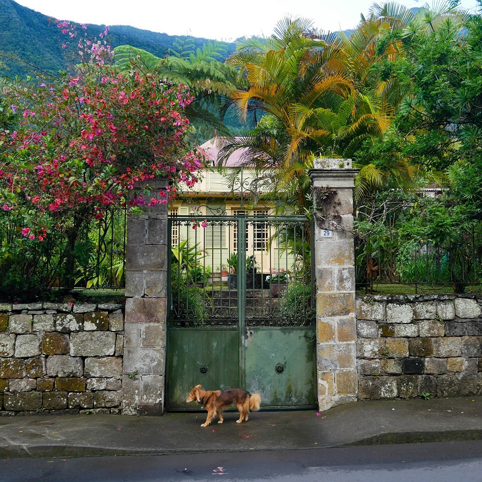
On the way, there are small houses colored or covered with vegetation. Then we take the small shortcut on the left by the old thermal baths! There may be 1/4 hour left before arriving… We go up the stairs that lead to the village… that’s it, we’re there. To end perfectly, we have lunch where we started our journey 4 days earlier!
We really hope this article will be useful for you to prepare your GRR1 trek! Don’t forget to check the trails’ condition on the ONF website and notify relatives when you go hiking.
Feel free to follow us on Facebook and Instagram to find out about all our adventures and ideas for outings!
Be First to Comment